Map
Please note: Locations and addresses are approximate and may not be as accurate as expected.
Planning
Planning status: Allocation
Planning authority: Worcester City Council
Application details:
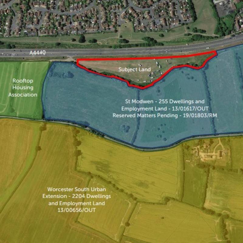
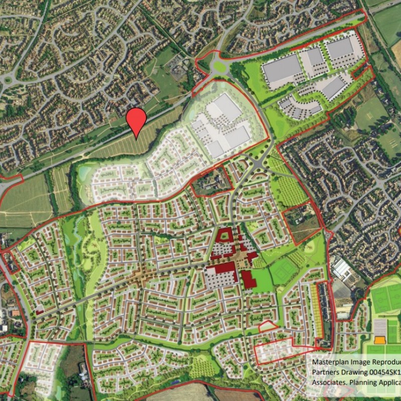
The site is situated within the planning jurisdiction of Worcester City Council. As set out in the South Worcestershire Development Plan (SWDP) the land is identified on the allocations plan as a local green network. However, it does not form part of the South Worcester Urban Extension as there is no agreement with the Promoter and as such currently provides no informal access or management.
On land near to the site, Welbeck Strategic Land LLP have a
resolution to grant outline permission (13/00656/OUT) for
2,204 dwellings and up to 14 hectares of employment land.
Immediately to the south bordering the subject parcel is an
outline consent owned by St Modwen for 255 Dwellings and
Employment Land (13/01617/OUT on the Worcester City
Planning Portal) and 81 units with Rooftop Housing
Association (P14L0266 on the Malvern District Council
Planning Portal).
LandHawk is a comprehensive database of recent and historical planning applications. Designed to deliver powerful, detailed search with greater accuracy and control.
Get instant insight into the status of any area within the country, with a reliable data source that combines 99% of all available planning application data across UK local authorities.
We have exclusively partnered up with LandHawk so you can immediately understand the planning situation of the empty property or site you are looking at. When you sign up and contacted by LandHawk, please say you singed up via LandAttic and you will immediately receive an extended 60 day free trial!
Ownership
LandHawk hosts, manages and displays a digitised version of every land parcel in the UK, as produced by His Majesty's Land Registry (HMLR) and, in the case of Scotland, Registers of Scotland using the INSPIRE data. Each land parcel contains the land registry title deed number and, in the cases of commercial and overseas ownership, directly accessible information for the ownership of that land parcel.
We have exclusively partnered up with LandHawk so you can immediately investigate the ownership of an empty property or derelict site you are looking at. When you sign up and contacted by LandHawk, please say you singed up via LandAttic and you will immediately receive an extended 60 day free trial!


