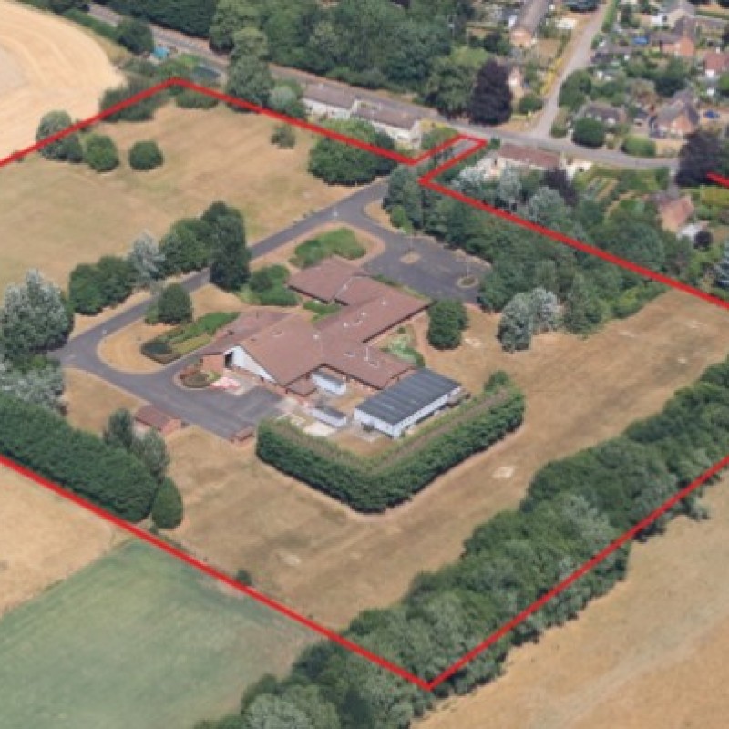
Map
Please note: Locations and addresses are approximate and may not be as accurate as expected.
Planning
Planning status: Outline Planning Permission
Application details:
Outline planning permission for up to 20 dwellings, with all matters reserved except for access, was recommended for approval in July 2018 subject to 35% affordable housing, sustainable Travel Packs, POS and maintenance, and POS and contribution towards a Community Hub for the Parish Council. This followed extensive consultation with the local authority, parish council and the local community, including public consultation events in October 2017 and December 2017.
Dialogue with the Parish Council and case officer continued following submission, including a site visit. Luddington Parish Council confirmed their support for the scheme in a consultation response to the local authority dated 15th May 2018, subject to green space to the north being gifted to the Parish Council, dwellings to fit local vernacular and policy compliant mix and affordability (both for consideration at detailed stage).
The case officer’s report to committee, confirms the site is a Large Rural Brownfield site within Luddington village and given there is limited likelihood of the site being utilised for employment purposes, the principle of development is considered acceptable. Development of the previously developed part of the site is considered to be acceptable, in relation to the Core Strategy, being appropriate to the immediate surroundings and to the overall size and character of the settlement. A mix of property types and sizes should be secured at reserved matters stage in accordance with the Core Strategy.
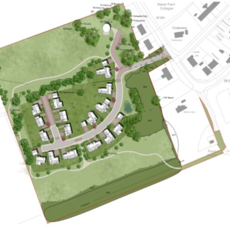
An illustrative masterplan was submitted with the application to show how the proposed development could be provided on site.This layout is not for approval, but for illustrative purposes only. Appearance, landscaping, layout and scale are reserved for future determination. Final unit mix will also be determined at detailed stage.
LandHawk is a comprehensive database of recent and historical planning applications. Designed to deliver powerful, detailed search with greater accuracy and control.
Get instant insight into the status of any area within the country, with a reliable data source that combines 99% of all available planning application data across UK local authorities.
We have exclusively partnered up with LandHawk so you can immediately understand the planning situation of the empty property or site you are looking at. When you sign up and contacted by LandHawk, please say you singed up via LandAttic and you will immediately receive an extended 60 day free trial!
Ownership
LandHawk hosts, manages and displays a digitised version of every land parcel in the UK, as produced by His Majesty's Land Registry (HMLR) and, in the case of Scotland, Registers of Scotland using the INSPIRE data. Each land parcel contains the land registry title deed number and, in the cases of commercial and overseas ownership, directly accessible information for the ownership of that land parcel.
We have exclusively partnered up with LandHawk so you can immediately investigate the ownership of an empty property or derelict site you are looking at. When you sign up and contacted by LandHawk, please say you singed up via LandAttic and you will immediately receive an extended 60 day free trial!


